High-resolution aerial imagery, thermal inspection support, condition documentation and 3D mapping for properties and infrastructure across New Jersey, New York, Pennsylvania and the greater Tri-State area.
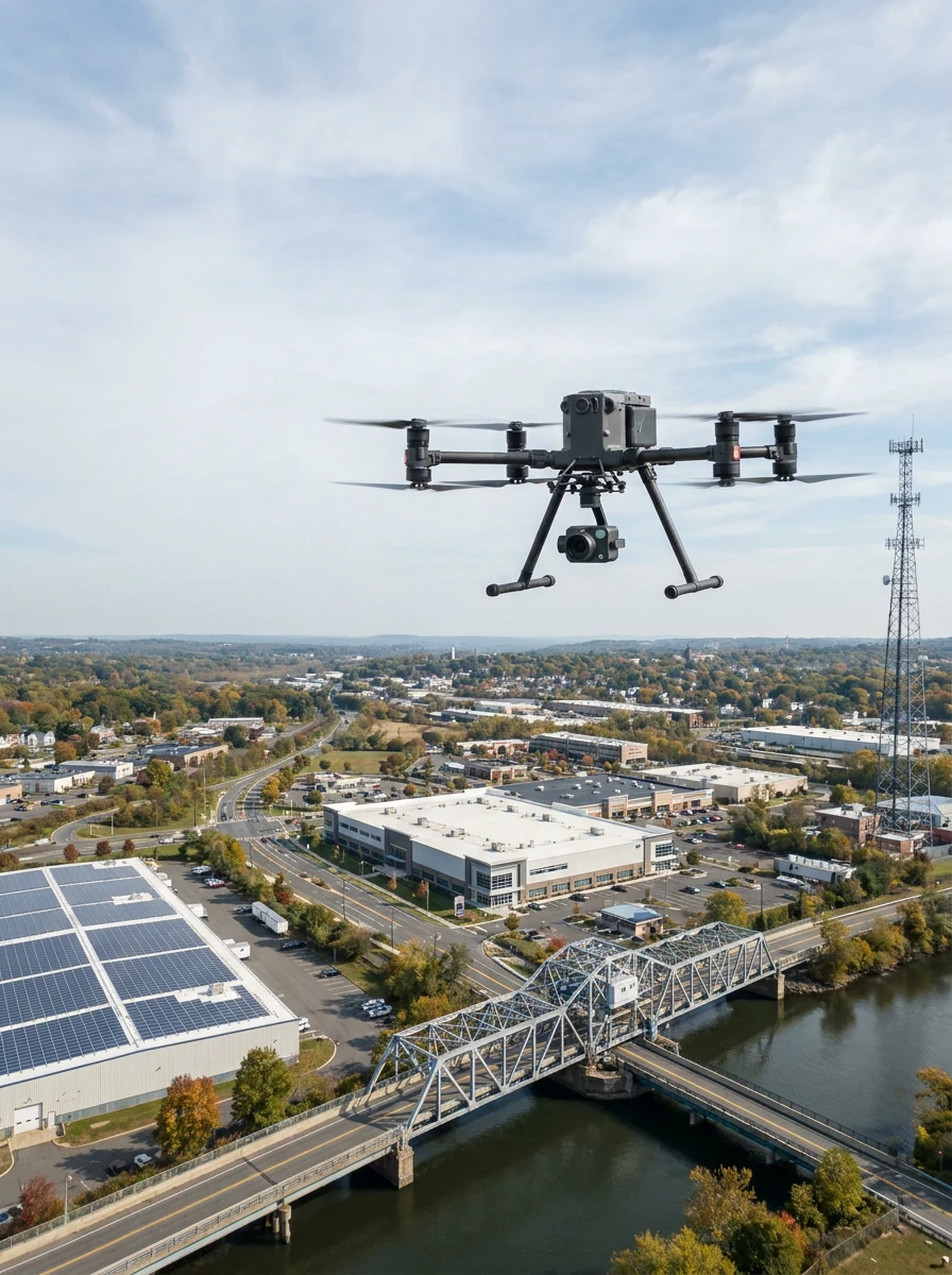
Drone Clean US provides drone inspection services for commercial properties, infrastructure, solar assets, vertical structures and hard-to-reach exterior areas. Project teams use our aerial data to document conditions, plan repairs, compare progress and maintain visual records over time.
The residential roof and home inspection service remains available for home inspectors, property managers, real estate professionals and building owners who need safer roof, chimney, gutter, siding and exterior documentation without routine ladder access or roof walking.
Flights are planned around site access, safety, airspace, weather, customer requirements and the level of documentation needed for the project.
Aerial condition documentation for commercial buildings, infrastructure, solar systems and vertical assets across NJ, NY, PA and the greater Tri-State area.
Commercial roof drone inspection, building envelope inspection and recurring condition documentation.
Emergency roof inspection and storm damage drone inspection with timestamped aerial records.
Solar thermal inspection, solar farm drone inspection and panel condition documentation.
Facade drone inspection support, aerial facade documentation and close-range exterior imagery.
Telecom tower drone inspection, elevated asset imagery, repair verification and 3D models.
Bridge drone inspection support, infrastructure drone inspection and engineering-team data collection.
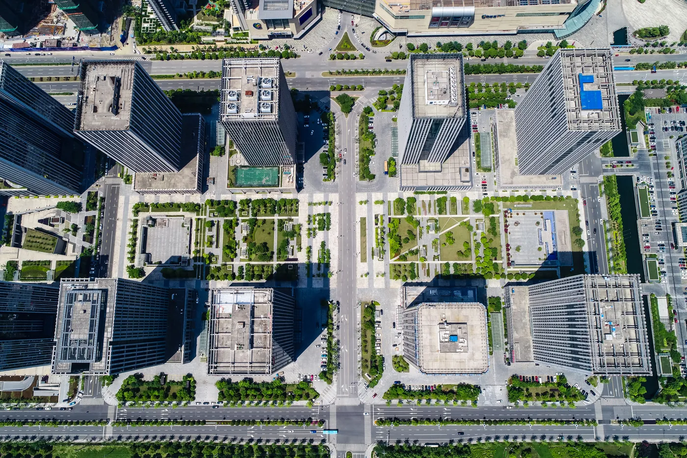
Commercial roof drone inspection helps contractors, property teams and building owners document roof surfaces, exterior components and repair progress without sending staff onto every roof area during preliminary visual review.
Request Commercial Roof Inspection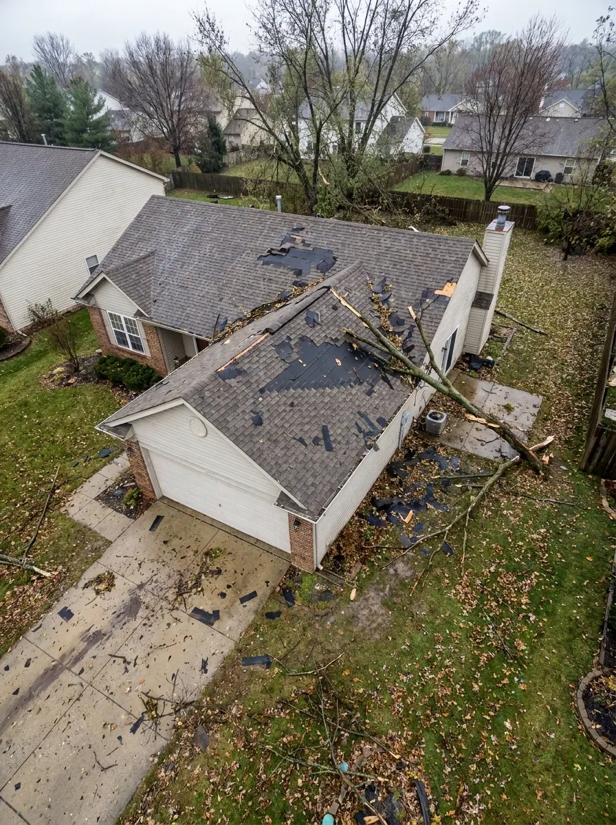
After severe weather or a site incident, rapid aerial photography and video can help teams document visible conditions, prioritize repairs and maintain timestamped records before work begins.
Drone Clean US provides visual documentation support. We do not perform insurance adjusting, determine claim coverage or provide structural certification.
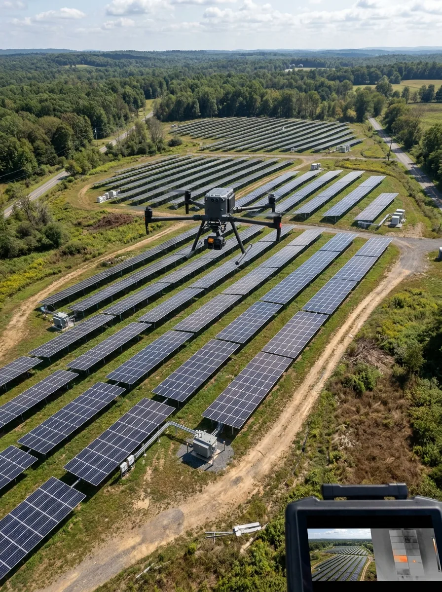
Solar farm drone inspection and solar thermal inspection support can help operations teams document panel condition, identify visible defects and prioritize maintenance across rooftop and ground-mounted solar assets.
Thermal inspections require suitable environmental conditions and specialized thermal equipment. Drone imagery and thermal data can support investigation, but not every electrical issue can be conclusively diagnosed by drone imagery alone.
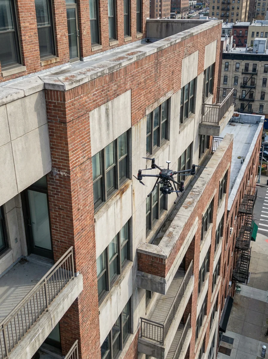
Aerial facade documentation provides high-resolution exterior imagery for condition documentation, repair planning, pre-cleaning review and post-cleaning records where legally and operationally permitted.
Drone imagery supports exterior condition documentation. It does not replace legally required hands-on facade inspections, professional engineering evaluations or NYC FISP inspections.
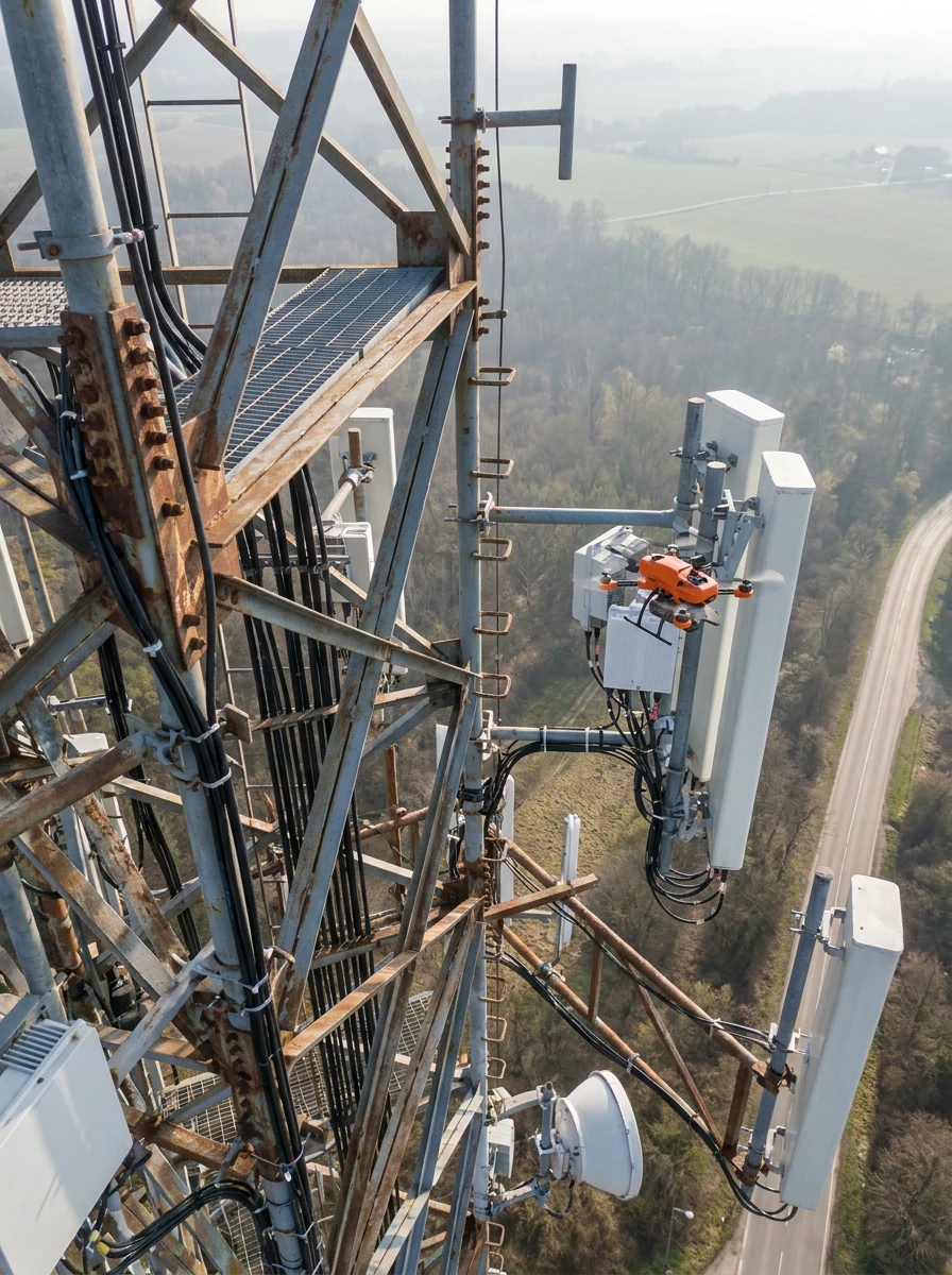
Telecom tower drone inspection and vertical asset documentation can help project teams capture high-resolution visual records of hard-to-access structures while reducing unnecessary climbing during preliminary documentation and repair verification.
Drone Clean US does not provide engineering certification or structural approval unless that work is performed by a properly licensed professional retained for that purpose.
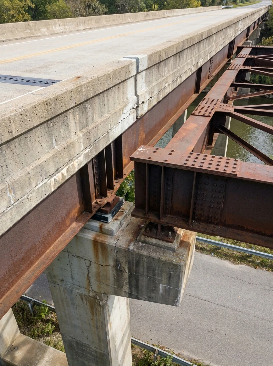
Drone Clean US provides UAS bridge inspection support, aerial data collection, and engineering documentation for professional teams that need organized visual records of infrastructure and hard-to-reach components.
Drone Clean US does not independently perform official NBIS bridge inspections, engineering certifications or final structural evaluations.
A Tri-State drone inspection company supporting commercial, municipal, engineering and infrastructure teams.
Property managers, building owners, facility managers, hotels, schools, warehouses and shopping centers.
Commercial roofing contractors, restoration firms, tree-removal companies and storm-response teams.
Engineering firms, facade engineers, architects, QEWIs, bridge consultants and construction inspection teams.
Solar O&M companies, asset managers, developers, EPC contractors and commercial property owners.
Telecom engineering firms, wireless contractors, tower-maintenance contractors and industrial facility owners.
Schools, municipalities, county engineering firms, rail and transit consultants and port or marine teams.
Your final package is organized around the asset, project scope and documentation requirements.
High-resolution aerial photographs, 4K video, close-range exterior imagery and before-and-after comparisons.
Annotated inspection images, damage-location documentation and repair-progress documentation.
Thermal imagery when applicable, including solar or envelope documentation under suitable conditions.
Orthomosaic maps, optional 3D models and roof mapping where supported by equipment, regulations and scope.
Organized folders by asset, building, roof area, elevation, component or customer naming convention.
Summary observation reports that organize visible findings without replacing licensed professional conclusions.
Exact deliverables depend on project scope, site conditions, equipment, regulations, flight authorization, weather and customer requirements.
A clear five-step workflow for safe drone data collection and organized inspection documentation.
We review the asset, location, access points, deliverables, timing and customer requirements.
We evaluate airspace, site constraints, safety considerations, weather and authorization requirements.
An FAA Part 107 certified pilot captures aerial imagery, video, thermal data or mapping inputs as scoped.
Files are sorted, labeled and prepared for customer review, annotation or reporting workflows.
You receive the agreed documentation package for planning, repair tracking, records or professional review.
Drones are useful where visual documentation is needed quickly, safely and repeatedly without unnecessary disruption.
Reduce reliance on scaffolding, lifts, ladders and rope access during preliminary visual documentation.
Capture visual records faster across roofs, facades, towers, solar arrays and infrastructure.
Document difficult angles, elevations and hard-to-reach inspection areas from controlled aerial perspectives.
Reduce disruption to tenants, building occupants, public areas and ongoing operations where conditions allow.
Create high-resolution visual records that can be compared before repairs, after repairs and over time.
Support annual, seasonal, post-storm and maintenance inspection programs with consistent documentation.
Serving commercial, residential, municipal and infrastructure projects throughout the region, subject to flight approvals, site access and safe conditions.
Newark, Jersey City, Hoboken, Edison, New Brunswick, Princeton, Trenton, North and Central New Jersey.
New York City, subject to applicable permits and operational approvals, plus other New York locations by request.
Philadelphia and Pennsylvania commercial, solar, infrastructure and property documentation projects by request.
Other greater Tri-State locations by request for portfolios, municipal projects and specialty asset inspections.
Drone operations are subject to FAA rules, airspace authorization, weather, site access, safety requirements, local restrictions and property approval. New York City operations may require additional permits and operational approvals before flight.
Drone Clean US provides aerial imagery, inspection support, thermal documentation, mapping and condition documentation. Drone inspection does not automatically replace required hands-on inspections.
Structural, electrical, insurance, code-compliance, facade-safety and engineering conclusions must be made by appropriately qualified or licensed professionals where required.
We support commercial roofs, residential roofs, building envelopes, facades, solar arrays, telecom towers, vertical assets, bridges, transportation infrastructure and other hard-to-reach exterior components when flight conditions and regulations allow.
Thermal inspection support may be available for solar, roof, building envelope and selected asset documentation when suitable environmental conditions and specialized thermal equipment fit the project scope.
Drones can reduce the need for some scaffolding, lifts, ladders and rope access during preliminary documentation, but they do not automatically replace required hands-on inspections or professional evaluations.
Drone Clean US provides aerial imagery, inspection support, mapping, thermal documentation and condition documentation. Engineering reports, certifications and professional conclusions must be provided by qualified or licensed professionals where required.
Priority storm-response scheduling may be available for wind, hail, roof leak, fallen tree, flood, fire-damage and construction accident documentation after safe access is confirmed and weather allows flight.
We serve New Jersey, New York, Pennsylvania, New York City subject to applicable approvals, Philadelphia, Newark, Jersey City, Hoboken, Edison, New Brunswick, Princeton, Trenton and other Tri-State locations by request.
Yes, we can provide telecom tower drone inspection documentation, vertical asset imagery and UAS bridge inspection support, aerial data collection, and engineering documentation for qualified project teams.
Deliverables depend on scope, but may include high-resolution photos, 4K video, annotated images, damage-location documentation, before-and-after comparisons, thermal imagery, maps, 3D models, organized folders and summary observation reports.
Yes. We can support engineering consultants, inspection vendors, roofing contractors, restoration firms, solar O&M companies, municipalities and other professional teams with aerial data collection and organized inspection imagery.
New York City drone operations may be available when a project can meet FAA rules, airspace authorization, weather, site access, property approval and additional local permit or operational approval requirements.
Send the asset location, project type and documentation goals. We will review the site requirements and follow up on scope, timing and feasibility.